


The exclusive data can power advanced data-driven projects for disaster management, water resources management and even national security
In its initiative toward achieving data-driven sustainability, the South Australian government has invested in advanced satellite imaging involving a ‘hyperspectral imaging camera’.
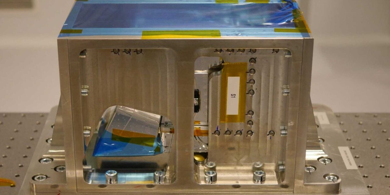
The camera is a three-in-one instrument that combines hyperspectral and thermal imaging with high-level data processing and AI capabilities in the visible and near-infrared range. This data helps researchers to analyze the composition of the Earth, along with three thermal infra-red bands to retrieve the temperature distribution, boosting and improving the number of Earth Observation applications that can benefit researchers in in the areas of water usage, climate policy and disaster management.

After innovative modifications for the purpose by cosine, the ‘HyperScout 2’ camera will be launched into space on board the satellite Kanyini, a 6U CubeSat, as part of the SA Space Services Mission to provide critical data to government and non-government agencies. The launch of the satellite is part of the South Australia Space Sector Strategy 2030 and is Australia’s first state-based satellite.
Also, the SmartSat Cooperative Research Centre is leading the mission and application prototyping, with Adelaide-based satellite manufacturing company Inovor Technologies designing and building the satellite, and South Australian space company Myriota contracted for the Internet of Things (IoT) space services.
According to Peter Nikoloff, Kanyini Mission Director, SmartSat: “We needed a compact imaging payload that gave us a nuanced Earth view. The spectral range of HyperScout 2 enables an extremely detailed analysis of land cover, supporting research into crop health, forests, inland water and coasts. The thermal infrared imager will provide vital information on heat generators in South Australia. In parallel with the development phase, SmartSat is formulating a research program with our partners to make optimal use of the systems once in orbit.”
Other research groups are considering applications of the AI module of the HyperScout 2 onboard Kanyini for bushfire smoke detection, monitoring water quality and advanced analytics for defense and security.


